Friday, 25 November 2011

Christchurch to Oamaru

Friday 25th November
Our tour being finished after breakfast, we started off with rather a fraught morning. We didn't get up until nearly 8, and about 8.30 Paul discovered that the car he thought he had booked for this morning was, in fact, not available. That left us with 90 minutes to breakfast and pack before we had to leave our hotel room, with nowhere to go! Fortunately, after spending about an hour on the Internet and the phone, he managed to secure another car, and we were picked up at 11, and were on our way by 11.30.

We had decided to go back to some places where we wished we had spent more time, so set off in the direction of Dunedin. We didn't intend to go right there, because there is an Elton John concert there tonight, so there aren't likely to be many beds.

The first part of the journey, across the Canterbury Plains, was fairly dull, I thought, but it became more interesting once the road came within sight of the sea. Paul began to find it difficult to focus after a few hours, so we decided to stop in Oamaru. We had visited there before, but only for half an hour, so we decided to see it more thoroughly this time.

We spent some time in the Visitors' Centre, where a short film gave us some brief history. The first settler arrived in 1853, but within 6 years, the town had expanded and flourished, largely because it had a harbour, and became an important port for the export of grain and wool, both of which were produced in quantity in the countryside around. There were gold rushes in the area too.


There were no trees at all near the town, but there was a lot of beautiful creamy white limestone, so that was used for building instead of wood. By the 1880s, the town was as big as Los Angeles, business was booming and had attracted a lot of banks.


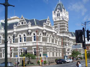
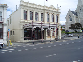
The building you can see just to the left of this very imposing building is where we are staying tonight, incidentally.

The original Post Office became too small and was not sufficiently imposing,


so this is what was built instead.


We took a lot of photographs of buildings we had rushed past on our last visit, and had time to go and look at things properly. There are certainly a lot of buildings to see. There are whole streets of beautiful old buildings. This is the port area, lined with 19th century warehouses, commercial buildings and grain stores.


The town declined in importance in the 1890s and there was, fortunately, never enough money to demolish the buildings during the years when such demolitions were a popular way of 'modernising'.

We spent some time at the Heritage Radio (Wireless The Way It Was). It was broadcasting some old Beatles classics when we were there. You can go in and visit the studio at any time; you can see the DJ was on air when we called.


He played an old 7 inch disc during our visit, and spoke to us while it was playing. There is a wonderful collection of old radios and gramophones, not to mention old vinyl.


Not only can you see all this in Oamaru, it's online as well. If you want to listen to a broadcast, try
http://222.154.238.34:88/broadwave.asx?src=1&rate=1
I can't seem to get it to work on this iPad, but it works fine on the PC. There is a web site too - http://heritageradio107fm.webs.com/

We had lots of time to wander about and chat to the locals. One lady gave us a demonstration of hand-loom weaving and showed us a spinning wheel which was somewhat larger than usual. It was called a walking wheel; you started the wheel spinning, then you walked sideways, drawing out the thread. Then you had to spin the wheel again to wind up the thread on the bobbin. I wanted to take a picture, but the shop was crammed too full of stuff and nothing showed properly on the photo.

It had got quite late by this time, and shops were shutting. The livery stable was still open though. It had a couple of carriages in it, and though there were no horses there at that moment, there had been some there recently, judging by the horsey smell!


We met a lady in Victorian costume who told us how often the town was used for films. Apparently it was most recently used as a standin for what a New Zealand girl imagined London would look like; this was for a film called 'Mr Pip' which is to appear at the Cannes Film Festival next May, so we'll look out for that.

We admired the old station; there are some freight trains now, but they don't use this station. It's disused, but fortunately has been well preserved.


After supper, we went to see the penguins. This was the best penguin viewing yet. No photos are allowed, so I can't post anything here. But it was a great place to watch the Little Blue Penguin, and we saw 172! You sit on tiered seats under a roof, so you are reasonably comfortable and you don't get wet if it should rain. The penguins come up from the sea and cross right in front of you to go into their burrows. Their nesting area is protected by a fence to keep out predators, and there are little holes for the penguins to get through.

They usually swim back from where they have been fishing in large groups called rafts. They climb up the rocks, then they pause at the top and catch their breath and preen a bit. When they are ready, they cross to one of the holes, waddling as quickly as possible. Because it's dusk, and they have dark blue backs, their silvery fronts flash as they waddle. They tend to hold the flippers out a bit to balance, like me crossing a plank bridge. They make quite a noise calling to their mates, who are in the nesting holes. Some of them can't quite remember where they live, and have to scuttle about searching for the right burrow.

Just after 9.30, most of them had come in, and we walked back to the hotel. We saw 4 more on the way, we weren't sure if they were lost and looking for the correct place, or, more likely, as they were two pairs, they were looking for a nice spot to build a new nest; the main colony is now somewhat crowded.

- Posted using BlogPress from my iPad

Thursday, 24 November 2011

Christchurch

Thursday 24th November
We rose late again, then spent some time on the internet before catching the bus into the city centre for some sightseeing. Not that there are all that many sights to see - you still can't get near Cathedral Square. Huge parts of the centre of the city are still fenced off, though Xmas decorations are starting to go up.


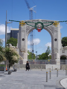
This is Remembrance Bridge. You can see it has been declared unsafe and is fenced off.

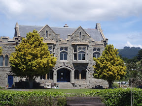
As our time was short, we took a tour (in an old London Routemaster) which conducted us round various parts of the city and the suburbs. Apparently, there are 1400 buildings to be demolished in the city centre, and they all have to be demolished carefully from the top down. The bus driver told us it had now been decided to re-build the cathedral, but perhaps not on such a grand scale. Many buildings will be re-built, though there are still arguments about how high to build in the future. We drove round the Arts Centre, which used to be part of the University before it became an Arts Centre. It will need considerable work.


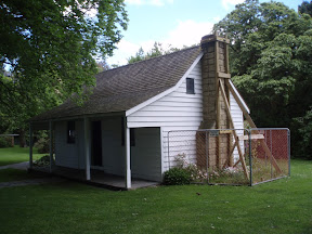
We learned something of the history of the area. The land around was bought from the Maori in 1848 and quite a bit of it was originally swamp, which has contributed to the difficulties caused by the earthquake. John Deans built Deans Cottage soon after that; it is the oldest surviving building in the area. Even it needed a bit of propping up after the earthquake.


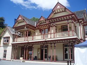
In 1854, having married, he started building Riccarton House from locally milled timber, though he died before it was finished. His wife and son moved into the house in 1856.


It was damaged in the earthquake, and is currently being repaired, so it isn't possible to visit. The cafe is still operating, but in a marquee in the garden - you can see a bit of it in the far right of the picture. At least it means some of the people employed there still have jobs. Apparently, 58,000 people used to be employed in the city centre, and though some offices have been able to move to the suburbs, many of the bar, hotel and restaurant staff are still without work, not to mention a lot of the shop staff.

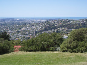
We made our way up the Port Hills, to an old building called the Sign of the Takahe, conceived as a rest stop on the way up the Summit Road. The old building has been closed since it has been damaged, but it can be repaired. You can't see it from the side I photographed, but this building is fenced off and nobody is allowed to enter.


The views from the summit are superb, right down to the sea.


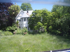
As we drove up and then down the hill, were able to see some of the earthquake damage. Most houses look fine, but many have roofs damaged or chimneys missing or walls propped up. Some are in a bad state. This one is falling sideways into the river. You can see how much it is leaning to the left - it isn't me taking a squint photo.


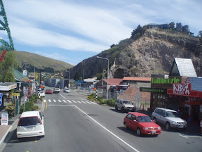
We drove out to the seaside resort of Sumner. Here, parts of the cliff have collapsed, taking houses with it. You may be able to see some houses hanging over the top of the cliff.


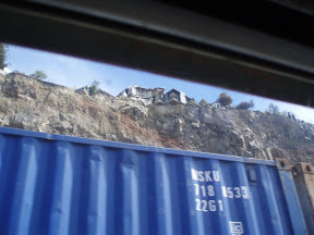
Old shipping containers have been stacked 2 deep along the foot of the cliffs to contain landslides. This is not a good picture - taken from the upstairs window of a moving bus - but it shows the top of one of the containers on the top row, and the shattered houses hanging over the cliff edge.


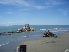
People still retain their sense of humour though. This was Shag Rock, but most of it fell down in the earthquake; local residents have re-named it Shag Pile!


We saw a lot of the damage as we drove around. One type of damage that is hardest to spot is the liquefaction; water and fine grained sand rose to the surface and foundations descended. You can see some areas where sand has risen through the grass, and there are some sinkholes as well. In some cases, not only have the houses to be demolished, but nothing else can be built on that land, either because it is unstable through liquefaction, or because it is threatened by landslides.

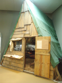
Once the tour was over, we took a quick trip round the museum. This has some interesting dioramas of Maori life and a lot of early Maori artefacts, but none photographable. I liked this depiction of an early settler cabin though.


I couldn't photograph the inside because of the reflections in the glass in the doorway, but there is some wonderful Victorian furniture inside.

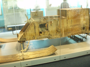
We only had 90 minutes there, so we could not do more than glance at a lot of the things. But I did manage to spend some time in the Antarctic exhibition. This had a lot of memorabilia from the Shackleton expedition of 1914, like this wonderful motorised sledge, which never worked properly.


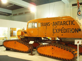
You can contrast that with the Snowcat from Vivian Fuchs expedition in 1957/8.


The clothes from the Shackleton expedition make quite a contrast with those of today too!

When they closed the Museum, we went and waited for a bus back to our hotel. We are both exhausted, but we have to be up and packed and out of our room fairly early, and off to pick up a hire car.

- Posted using BlogPress from my iPad


Wednesday, 23 November 2011

Omarama to Christchurch

Wednesday 23rd November
We left Omarama in fairly bright weather but we headed inland towards Mount Cook and it soon became very cloudy and then very rainy. It was also very windy, so any scenic flights round Mount Cook were cancelled, causing some people to be very disappointed. You probably couldn't have seen much through the mists of rain anyway. The alternative plan, failing flights, had been to do a walk from Mount Cook village, but almost nobody felt inclined to walk in the driving rain, so most of us went into the Sir Edmund Hilary Alpine Centre. There was an interesting little museum about the history of the area, as well as some memorabilia from Sir Edmund Hilary. Mount Cook was first climbed in 1894, and the Hermitage, still the only hotel in the park, was built the following year. Apparently, tourists used to be ferried up to the hotel by coach, but it took days.

In 1906, this De Dion Buton made the first motorised trip to the hotel, and that proved that motorised transport was possible.


Below is the original vehicle which brought the visitors up from Fairlie.


Because of the constant danger of breakdowns in such a remote place, it carried a basket of carrier pigeons so if there were a breakdown, messages could be sent back to Fairlie requesting help. Carrier pigeons were also used to notify the hotel about how many people were coming up; later, telephones were installed so the pigeons could be retired.

After our brief visit to Mount Cook National Park (Mount Cook itself largely invisible) we drove out of the park and down through the Mackenzie county to Lake Tekapo for lunch. Lake Tekapo is the most beautiful greeny-blue colour, and has a wonderful background of snowy mountains. The colour is caused by 'rock flour' - finely ground particles of rock brought down by glaciers and held in suspension by the melt water.


After lunch we paid a quick visit to the Church of the Good Shepherd, built in 1935 to provide for both tourists and local people. The name is explained by the fact that Mackenzie county is well known for sheep farming; it was named after somebody called Mackenzie who brought the first flock of sheep into the high country in the mid 1800s.


The church was build of stone from the surroundings, and behind the altar is a huge window looking out on the lake, so the view is wonderful. My camera can't cope with the differences in the light levels, but it gives you an idea.


Not far from the church is the statue of a border collie.


The statue was erected in appreciation of the collie dog, without whose help the grazing of this mountainous country would have been impossible

We set off again, this time for Geraldine, home of the world's largest knitted jersey. I kid you not - it's in the Guinness Book of Records!


The man who knitted it (with a knitting machine) worked at a knitting factory where every year they threw out hundreds of thousands of little cogged wheels. He took these wheels and broke off the little cogs and used them to make a mosaic of the Bayeux Tapestry. There are over 2 million tiny little pieces. This is one of the more recognisable bits, the death of Harold.


He has also extended the Tapestry up to the Coronation of William, and he says he has another bit ready which recounts the story of the Battles of Fulford Gate and Stamford Bridge (the first when Edwin and Morcar failed to halt the Northmen, the second when Harold utterly defeated them).

Anything else after that must be an anti-climax. However, we did make a quick toilet stop at the big salmon!


Then we headed into Christchurch for our final two nights.

- Posted using BlogPress from my iPad
Tuesday, 22 November 2011

Dunedin to Omarama

Tuesday 22nd November

We woke this morning to bright sunshine, and reflected on how lucky we are. We heard on the news that west coast of South Island has just had 250mm of rain (that's nearly 10 inches) in 48 hours, and there is a lot of flooding. Cows and sheep have drowned in the fields, and in Greymouth, the Grey River is less than a foot from overtopping the flood wall where we walked seven days ago.

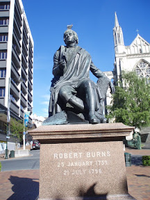
After breakfast we had a short time to explore the city before we had to be on our way. We walked down the very steep hill to the Octagon, an eight sided open space which marks the city centre. The is a statue of Robert Burns in the middle, so I took a photo. I had to have the gull on his head though - it did not respond to being told to shoo!


I was obliged to spend some time in the Telecom shop, trying to extend the life of my 3G Internet connection which was due to expire in a few days. I have no idea who designed their method of topping up the data, but it is set up for phones not iPads, is impenetrably complicated and not in the least intuitive. Anyway, it seems they gave me the correct advice as to how to do it, so I have lots of data and another month's worth of time - which I won't need, as we are only here until December 10th.

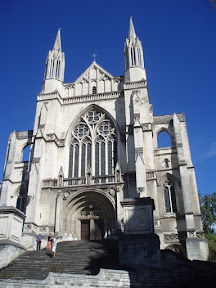
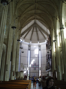
We went to see the cathedral, built in 1919 which replaces one built in the 1860s which was demolished to make way for this one.


The chancel was not completed until 1971 though, and you can see the difference.


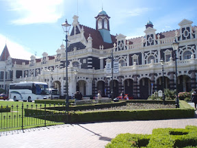
The bus drove us through the town and down to the railway station, which is an amazing building.


The inside is also quite special


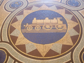
and it has some good mosaics on the floor too.


Opposite the station are the Law Courts and the original prison, now the central police station. They are both very gothic looking buildings.


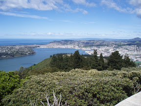
The bus took us up the winding drive to the top of Signal Hill. There were wonderful views over Dunedin, both the town and the harbour.


There is a monumental memorial to the first pioneers, and a big chunk Edinburgh Castle rock.

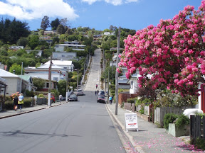
Our last visit was to Baldwin Street, which is reputed to be the steepest residential street in the world. It is certainly very steep - much steeper than it looks in the photograph.


It wasn't the walking up I found difficult - I just went slowly - it was the walking down. It is hard not to find yourself going faster and faster. Crossing the street at the steepest part is pretty difficult too, it's hard to keep your balance.

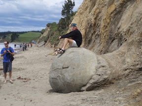
After that, we left Dunedin and set off for the Moeraki Boulders, where we also lunched. The boulders were formed on the sea bed about 60 million years ago as lime salts gradually accumulated around a hard core. We didn't see as many of them as you see in the postcards, because it was high tide so some of them were under water. Nevertheless, they are an interesting sight, and many of them are quite big. A passing tourist sat on one so his sons (or grandsons) could take a photo, so I just took one as well.


Not far away is the town of Oamaru, which has the best preserved collection of historic public and commercial buildings in New Zealand. They were built in the 1880s from Oamaru stone, a local cream coloured limestone. As we only had half an hour there, it was hard to see everything, but some of the buildings were really lovely.


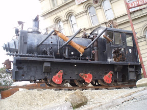
What also took my eye was the Steampunk, an old steam engine which has been modified with guns, torpedoes, a skeleton, a dragon's head and lots of steam pipes. If you put $2 in an attached box, steam comes out of every orifice, and it makes steam train noises!


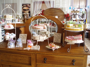
I was also very taken with the shop that made wonderful soaps that looked just like cakes or puddings. I wanted to buy something, but there was no time to choose anything.


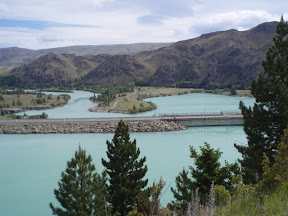
We drove down the banks of the Waitaki River, past several of the dams of the hydro development scheme. The Waitaki Dam was the first we passed, noticing that the water is a wonderful bluish-green. The Aviemore dam is the next, and we crossed that to drive along the far side of it. Then we crossed back across the Benmore dam, getting some lovely views.


We eventually stopped at Omarama, a tiny place which seems entirely dedicated to tourists on their way between two more interesting places.


- Posted using BlogPress from my iPad

Monday, 21 November 2011

Te Anu to Dunedin

Monday 21st November

We left Te Anu on a rather grey morning, though at least the overnight rain had stopped. I was so depressed by the grey weather, I forgot to take a photo, though the lake is beautiful and our hotel was right on the shore. I shouldn't complain really, we have mostly been quite lucky with the weather. We should have expected rain in Milford Sound, it's the second wettest place on earth, usually averaging 7 - 10 metres of rain a year. That's between 23 and 33 feet, for the non-metric. One year, they had 14 metres - that's about 46 feet of rain! No wonder the rain forest is constantly dripping, and there are waterfalls everywhere.
We passed a lot of typical sheep farming country, with rolling hills


and made a mid-morning coffee stop in Gore. There had been a lot of rain there too, the river was very high and the fields flooded. You can possibly just see the poor sheep sheltering away to the far left of the photo.


The next town along from Gore, interestingly enough, is called Clinton! Before we got there, the rain had started again, but fortunately it didn't last.

At lunch time, after a rather pedestrian drive, we reached Dunedin, and immediately drove out long the Otago Peninsula to go to the Royal Albatross Centre. It was a very scenic drive along the waterside, with lots of lovely views over the harbour.


At the Royal Albatross Centre, we saw lots of things, but not much of the albatross. We had a short film about the albatross, and we could see one sitting on its egg on the live camera. We walked up to the Taiaroa Head Gun Battery where there is an observatory, but we could only see the head of an albatross as it sat on the nest. We were shown various examples of the size and weight of the chick at different ages and learned about the dangers of plastic waste to the birds. The Gun Battery itself is quite interesting. It was built in the 1880s to combat a perceived threat from Russia, and contains the Armstrong disappearing gun, a 6 inch diameter naval defence gun designed to pop out, fire and then recoil back into its pit. It is the only one of its kind in the world still in working order and in its original position, and has never been fired in anger.


We also saw the nests of Stewart Island shags, and a huge colony of gulls.


We tried to say hello to Mrs Gull and the kids, but she was too busy giving them their lunch, so we went off to have ours, somewhat late.


Our bus continued round the headland, up a very steep and winding track, to Nature's Wonders, where we were issued with raincoats to protect us from the mud, got into 8 wheel drive vehicles and headed off up and down incredibly steep slopes to see views and wildlife.


Paul videoed part of our journey, but I was incapable of photographing anything because I was hanging on like grim death with both hands (not to mention pressing my knees on the side and bracing my feet on the floor - I'd have held on with my teeth if I could). We did stop at the top of the hill for some spectacular views


before heading down the cliffs to the seal colony. There were quite a few seals on the rocks below, including some mothers suckling babies.


While we were photographing them, we suddenly had to move out of the way of a very determined seal who wanted to go past. Apparently it is advisable not to block their passage; they might look charming with their liquid eyes, little folded ears and cute black nose and whiskers, but they also have big sharp teeth and are not slow to use them.


We climbed back into the little vehicles and bucked and heaved our way round to the penguin colony. These are extremely rare and endangered yellow eyed penguins, there are only about 400 left in the world. They live on a beautiful sandy beach


backed by an inclined slope covered in wildflowers.


The penguins are so far away that my camera zoom couldn't cope with them; some of those almost invisible specks on the beach are penguins. Though Paul got a good clear picture, the penguin was preening its back, so it appears to be headless!

After our scenic 8 wheel drive safari, we got back into our bus and headed back along the Otago Peninsula by a different route. We had views of the wonderfully folded landscape of the peninsula


the harbour


and this rather strange art installation; some of my family may find it more interesting than others! Why there should be a set of large teeth here I have no idea!


- Posted using BlogPress from my iPad