Saturday 29 June 2019

Linlithgow and Falkirk

Friday 28th June
Today being our last day in Scotland, we decided to visit Linlithgow Palace, a place we had never visited in spite of its being only 15 miles from Edinburgh, where we lived for 5 years. The palace is best know for being the birthplace of Mary Queen of Scots, but it seems to have had a very long history before that, and a lot less afterwards.

Apparently the site was first occupied at least 2000 years ago; remains of a cranog have been found in the Loch. A royal manor is known to have existed on the site since the 12th century. Edward lst (Hammer of the Scots) invaded Scotland and, finding the manor had potential as a military base, fortified it in 1302. It was re-taken by the Scots some years later, and restored as a royal residence. In 1424, King James lst of Scotland decided to turn it into a grand palace, and it was later added to by James lll, James lV and James V (father of Mary Queen of Scots; he was also born there). Mary herself sometimes stayed there during her reign, but when her son James Vl of Scotland became James l of the two kingdoms, the royal court moved to England and Linlithgow was little used and fell into disrepair. James had some repairs made, but the palace continued to be unused and parts became quite ruined. The final blow fell when the Duke of Cumberland had it burned down following the defeat of the Scots at Culloden. So now it is just a ruin, but one which gives some hint of the magnificence in which the Scottish monarchs lived.

This is the outer gateway or fore gate, an impressive entrance to the outer enclosure surrounding the palace. It was created for James V in 1535.


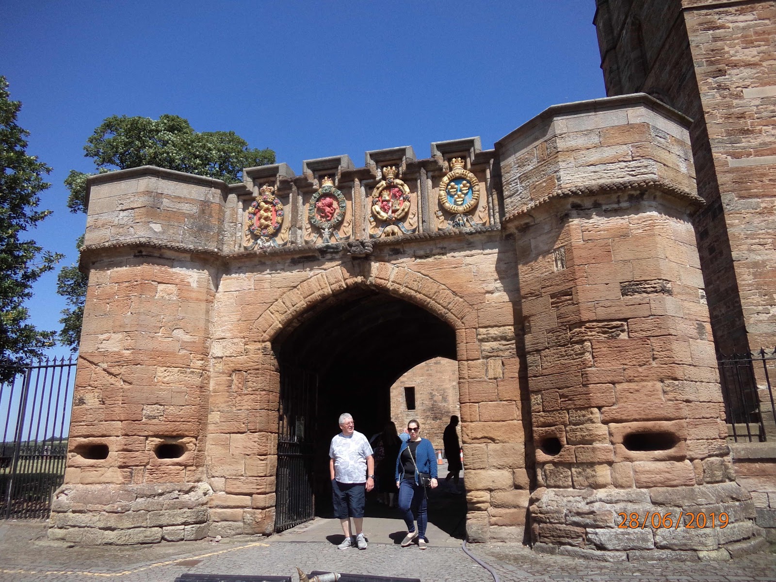
James belonged to 4 European chivalric orders, so he had these memberships displayed in the armorials above this entrance arch. He obviously hoped to impress visitors with his importance and international allegiances!

Once through the gate, you travel across the outer enclosure up a sloping approach to the palace itself.


This is the south front which became the main entrance around 1535. The big arched windows you can see on the first floor lit the royal chapel behind them. You go through the gate and into the courtyard, dominated by the fountain. 


The fountain was also created by James V, around 1538. He wanted to declare his power and sophistication. The crown on top represents the King’s superiority, and there are sculpted figures, some mythical, some symbolising James’ status as a patron of all the arts. 

The courtyard is surrounded on all 4 sides by different quarters representing building contributions by different monarchs. We started in the west quarter, to the left of the entrance gate, though that isn’t the earliest part. It contained the king’s lodgings, hall and presence chamber, installed here by James lV, though it was hard to understand all of them from the little that is left. 


This was the presence chamber, where James V added the ‘ladder window’ to bring more light in, as he thought it was too dark. You can see that the upper floors as well as the roof are missing. Most of the building was at least 4 stories high, but the roof is missing and most of the upper floors, though there are some remaining on the first floor in some quarters. 

We climbed one of the towers for magnificent views over Linlithgow and its Loch. The towers are largely intact and you can climb right to the top.


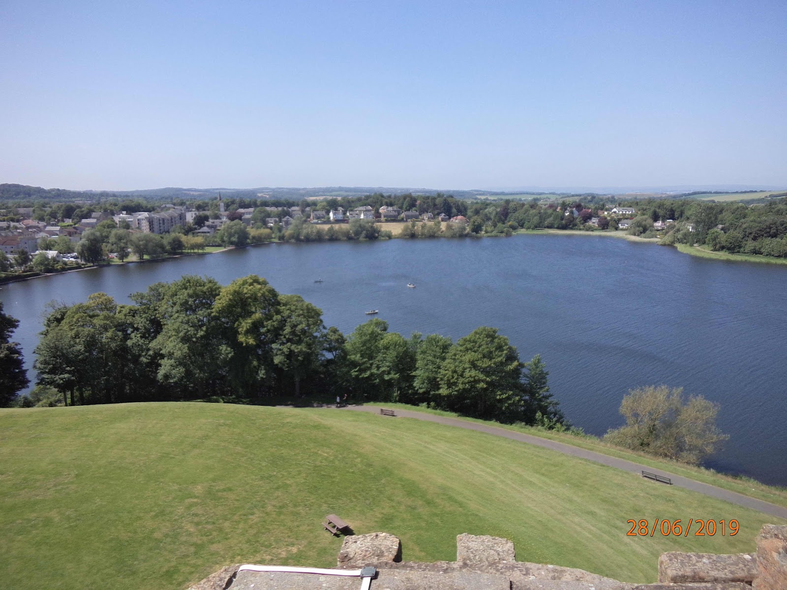
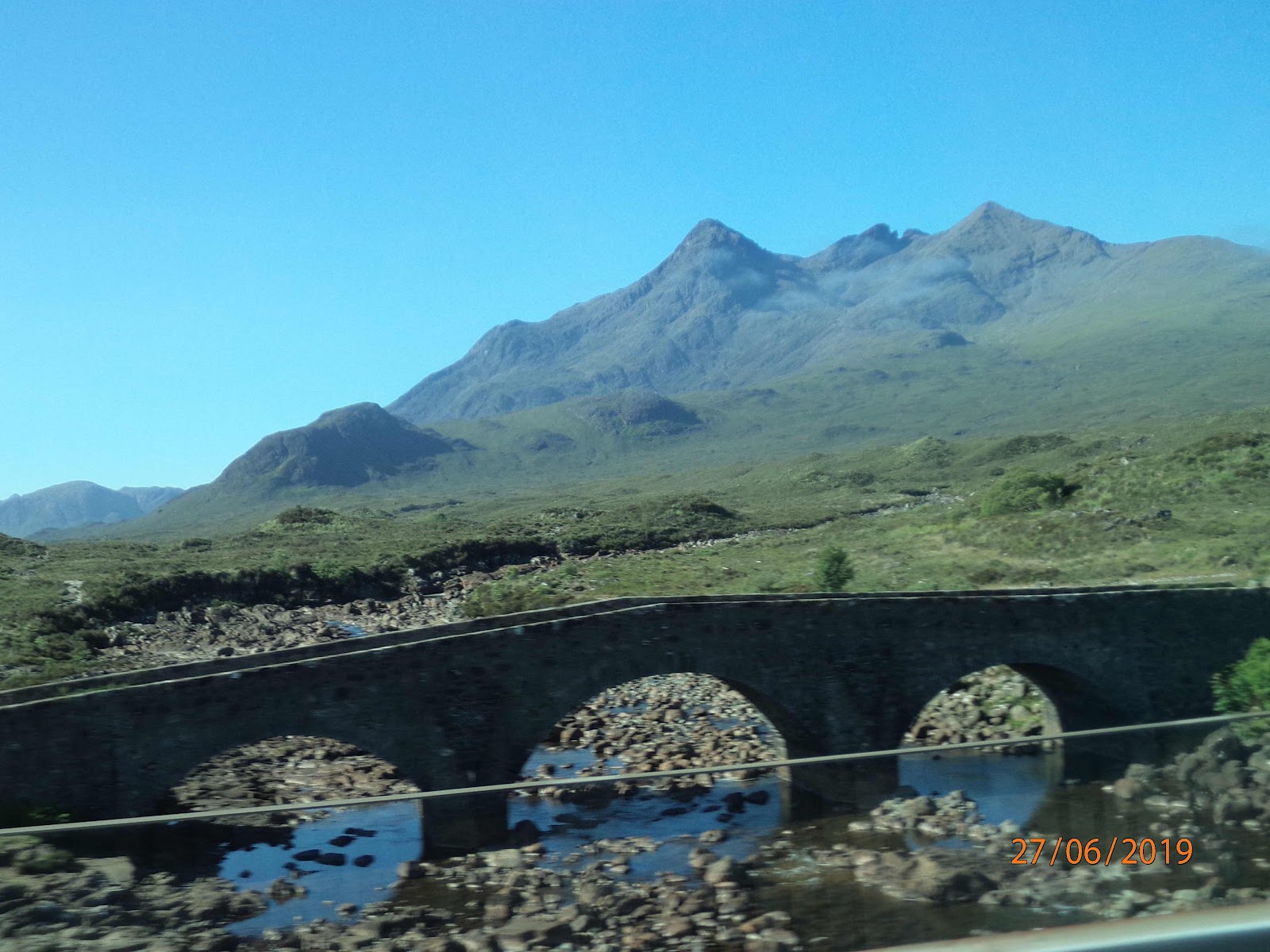
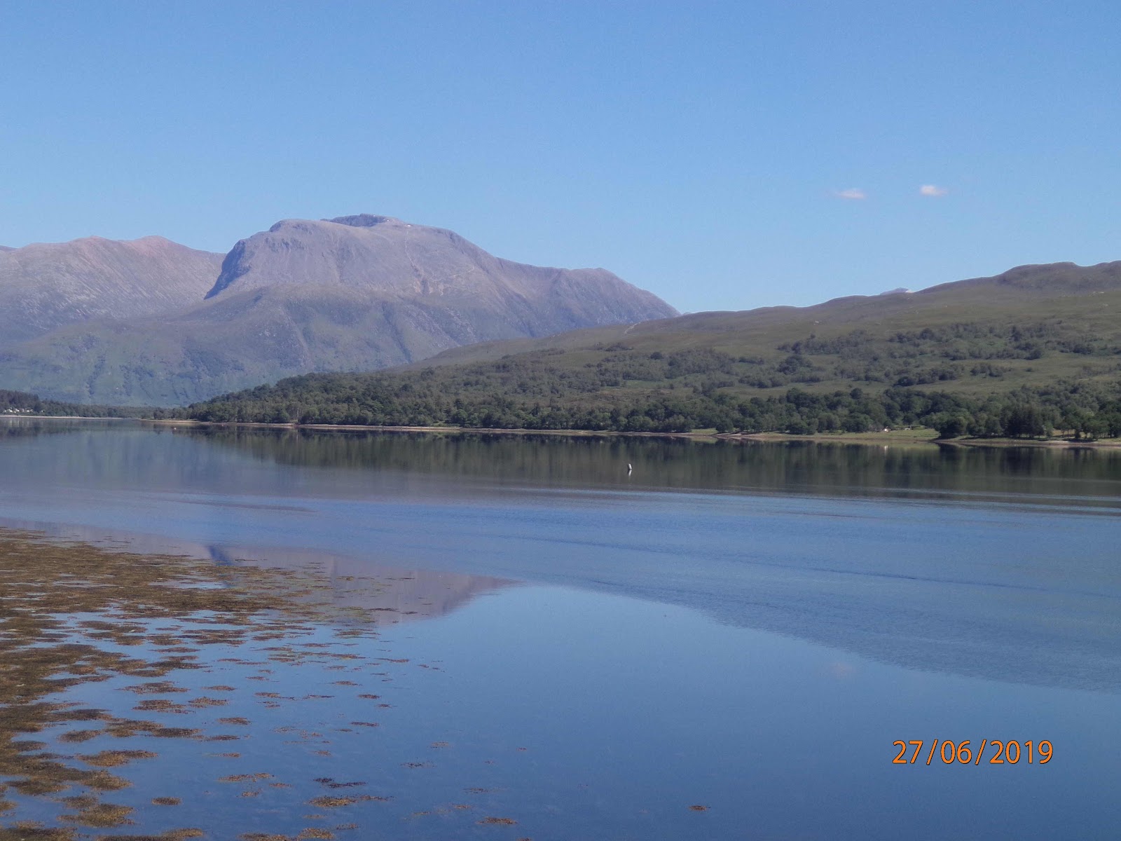
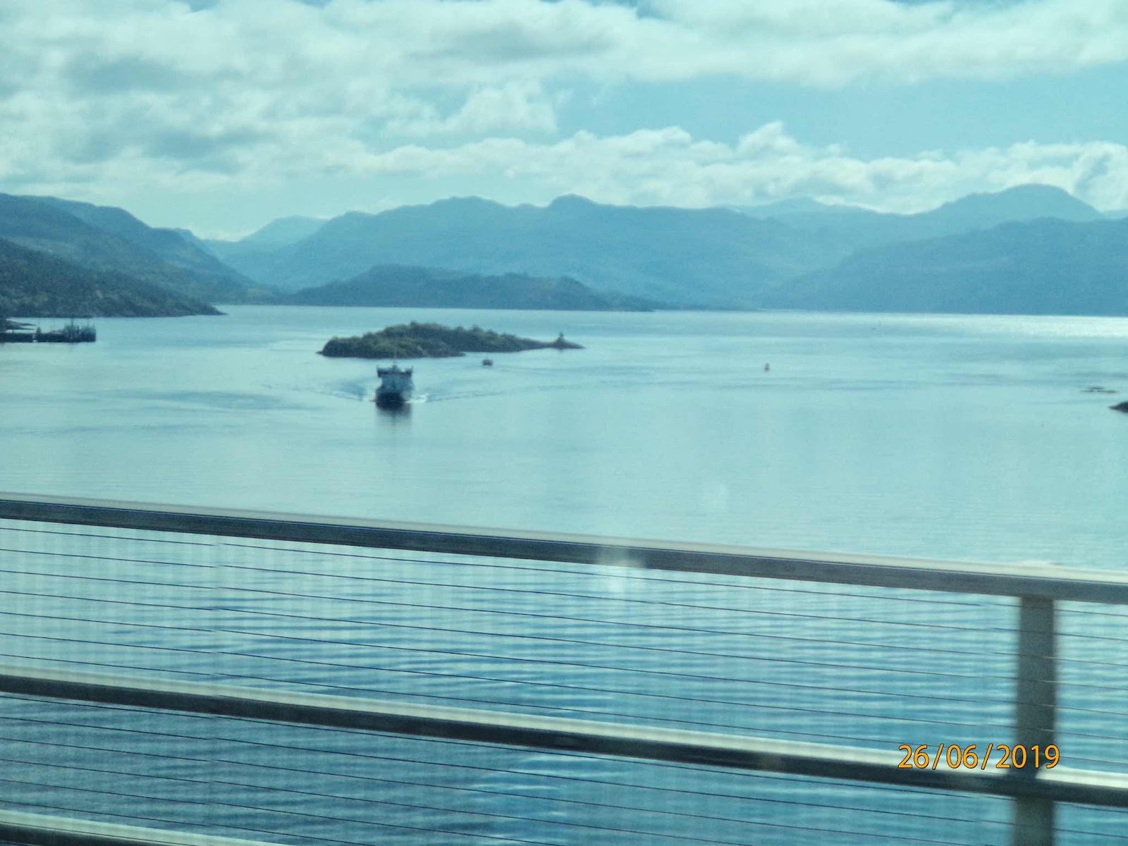
The Loch was formed during the last Ice Age. The glaciers retreated, leaving a huge block of ice. As it melted, sediments built up and a water-filled depression was left. It’s an important area for wildlife, and also for the local population. Depending on the size of your screen, you might be able to see the rowing boats out in the Loch; no doubt they are popular on such a lovely warm day.

This view of the palace interior from one of the tower windows, gives some idea of the size of the place. These are the top three storys of 4 or 5.


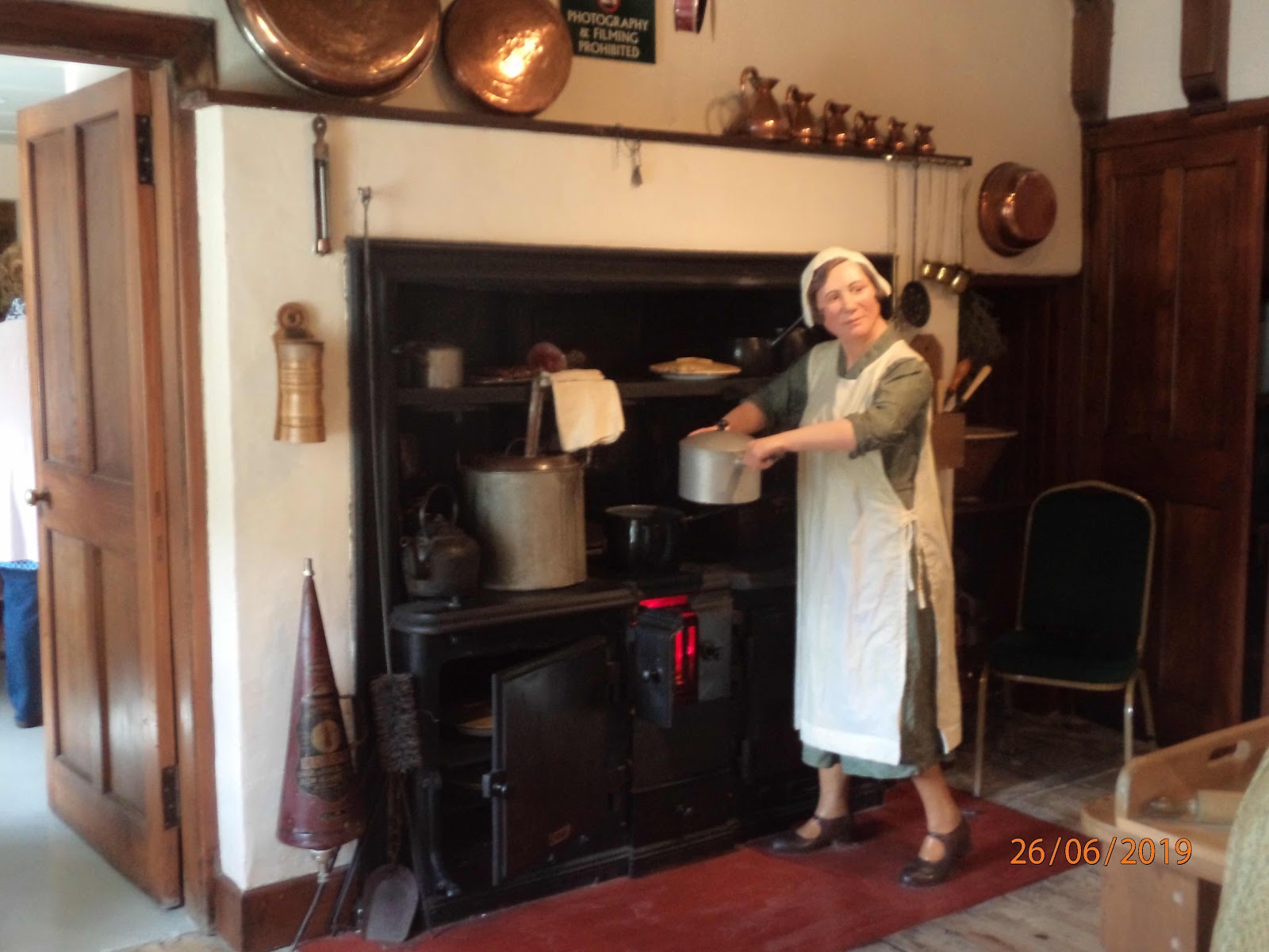
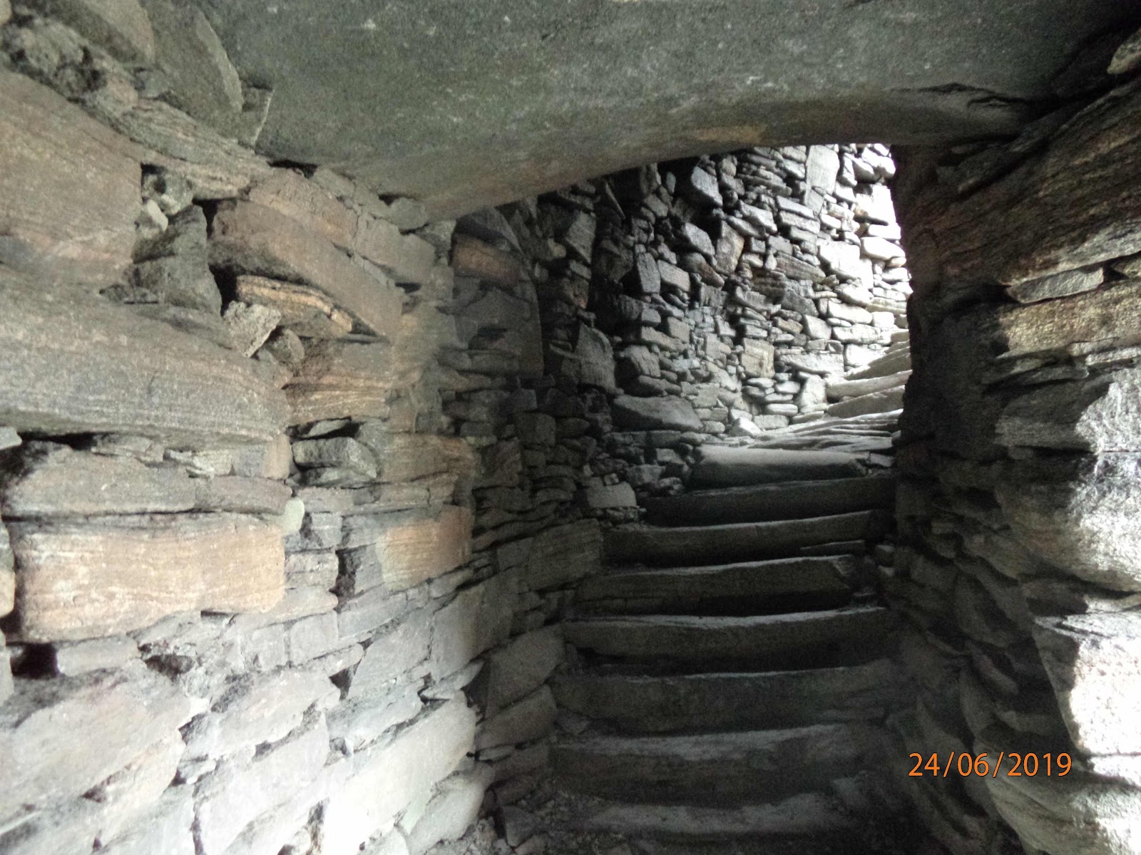
You can also see the ruined state, and appreciate how difficult it must be to stop the place from falling down completely. There are far too many plants growing in the ruined walls, which can’t be doing them any good.

The earliest part of the building is the East quarter, and it contains the Great Hall, built by James l for feasting, celebrations and grand gatherings.


I’ve had to lighten this photo considerably because the far end is in such deep shadow and I wanted to point out that those 3 huge square things at the far end are in fact part of a huge fireplace that occupies almost the entire wall! If you look closely, you may be able to see that the fireplace canopy projects out from the wall, and is held up by the 4 pillars. The fireplace in the kitchen next door to this hall is equally enormous, quite big enough to roast a whole ox!

After spending a couple of hours exploring the palace, we went to the adjoining church, St Michaels, which is a similar age to the palace.


Although there has been a church on this site for over 1000 years, this one was mostly completed around 1490, though the apse was added later. The ceiling used to be of wood, but this was found to be rotted and was replaced with the current plaster in 1812. There are some very interesting parts to this church - like the fact that what is now a display case at the back of the church used to be a lepers’ squint. Lepers were not allowed in the church but were allowed to watch the service from outside, through the squint which was a little window at a lower height than most church windows. There are also marks on a pillar at the back where Oliver Cromwell’s soldiers sharpened their swords, as well as bullet holes.

You can see the results of the reformation on this church. The outside used to be adorned with a great many statues in specially created niches. The statues were smashed at the reformation, but the niches remain, some of them with remnants of statue inside.

By then it was long past lunch time, so we visited a nearby cafĂ© for a quick lunch, then made our way to Falkirk to see the Falkirk Wheel. This is is a rotating boat lift, connecting the Forth and Clyde Canal with the Union Canal for the first time since the 1930s. These canals were previously connected by a flight of 11 locks, but the locks fell into disuse and were dismantled in 1933 and the canals were subsequently filled in. 

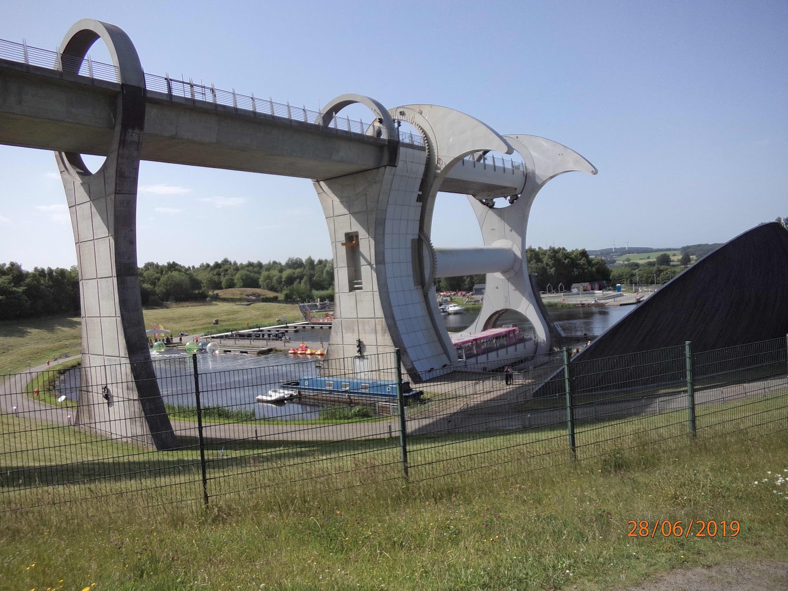
The British Waterways Board planed was to regenerate the canals and reconnect Glasgow with Edinburgh. Planners decided early on to create a dramatic 21st-century landmark structure to reconnect the canals, instead of just recreating the flight of locks.

The wheel was opened by the Queen in 2002 and raises boats by 79 ft. It is the only rotating boat lift of its kind in the world, and one of only two working boat lifts in the United Kingdom. It really is an amazing sight.


This is what it looks like as you approach it. The upper canal runs along in what looks like a concrete trough, and the boats will be lowered from there to the pool below. At the same time, boats from below will be raised to the upper canal.

This is the start


The boat nearest the camera is waiting its turn to go into the lift. There is already a boat in there, an orange coloured one, just under the blue circular sign that says Scottish Canals, and the boat waiting is too wide to fit in alongside it. There are two boats in the upper canal, which you can’t see yet.

Then the wheel begins to turn. This is the half way position


You can see the orange boat going up on the left. The two boats which were in the upper canal can be seen now, one has a pink roof and the other is a traditional canal narrowboat, so narrow that it can fit alongside the pink boat.

The next photo shows the cycle nearing the end.


The orange boat is nearly up to the top canal, and the two other boats are nearly down to the pool.

This is the final position.


The orange boat is at the top and is about to sail away. At the bottom, the narrowboat has already left and is sailing away, and the pink boat is just waiting for it to get out of the way. Once both are out of the way, the boat nearest the camera will go in and be taken up - though it may have to wait for something else to be ready to come down. It was getting late, so we didn’t wait to see. 

We drove back to Edinburgh and made our preparations to leave. Tomorrow, we go to visit family in Cheshire. 


Friday 28 June 2019

Skye to Edinburgh

Thursday 27th June

Today we started driving south on Skye towards Armadale and I finally managed to get a photo of the peaks of the Black Cuillin as the mist hadn’t descended, as it had on other days.


Once we had arrived in Armadale, we walked up through the Castle estate towards the museum. There were some beautiful trees in the garden.


The Museum is called The Museum of the Isles. It concentrates on the History of Clan Donald, which had a profound influence on Highland history. Clan Donald ruled the western seas for almost 400 years, virtually independent of royal control and with an empire big and powerful enough to challenge the Scottish Kings. They were called Lords of the Isles, and remained so until 1493, when the Scottish King took the title away.

Clan Donald is not only one of the oldest but also one of the biggest of all Scottish clans. The museum showed a list of all the surnames associated with the clan, and it was here I found my own maiden name so I was delighted to find my family were part of the clan.

The museum outlined a great many feature of highland life, illustrated with artefacts and photos. It detailed the history of the Jacobite rebellions, and explained the rise of the popularity of tartan after its earlier suppression, the history of the Highland Regiments, the use of bagpipes, and the emigration of so many Scots abroad. We would have spent longer here, but time was pressing and we had a boat to catch, so we spent our last minutes looking at the ruins of Armadale Castle.


This Castle is not particularly old. Clan Donald established itself on Skye in the 15th century, but at first occupied houses nearby. They only began to stay in Armadale in the 1650s and a new mansion was built on the present site in 1790, some of which survives today as estate offices. In 1815, this was extended and included lavish interiors, arcaded public halls and a marble staircase. A fire destroyed part of it in 1855, and it had to be rebuilt. In 1925 the MacDonald family moved to a smaller house, leaving the castle abandoned, and it gradually became derelict, which is all rather sad.

After that, it was time to leave the beautiful island of Skye, and we were all very sad to do so. We had so much enjoyed the lovely scenery and the friendliness of the people we had met, and we would all have liked to have been able to stay longer and see more. 


This was our final sight of Skye, as we sadly sailed away on the ferry Lord of The Isles, making for Mallaig. It was a short journey across the Sound of Sleat, and we approached Mallaig within half an hour.


This is the pretty harbour at Mallaig, where we were fortunate to spot a dolphin. Sadly, by the time I had got my camera out and prepared it, the dolphin had gone. We had a snack in Mallaig (and some retail therapy) and then it was time to board the Jacobite steam train for our journey to Fort William.


The locomotive had to be photographed from the road, as the train is longer than the platform so we couldn’t get near it. We even had to walk right along to the end of the platform and get into a carriage that wasn’t ours, then walk through to ours, as our carriage wasn’t at the platform either.

When the train started, the line was close to the coast and we had beautiful views of the island of Rum, Eigg and Muck. Then the train turned inland and we had views of Loch Eilt. Then we were warned that we were approaching the Glenfinnan Viaduct, and there was a rush to the windows. 

The viaduct is built of concrete and is quite spectacular, having 21 semicircular spans. It is the longest concrete bridge in Scotland, being 461 yards, and crosses the River Finnan at a height of 100 feet.  Since it is so high, the views are superb. 


I took photos of the Viaduct itself before and after we crossed it, and the better photo was after we had crossed it.


 You can see all the other passengers leaning out of the windows to take pictures. Harry Potter has made this a very popular journey!


Next, we passed Loch Eil on our way towards Fort William


With no guide to tell us what we were looking at, I have no idea of the name of this mountain, unfortunately. We crossed the Caledonian Canal, and had the opportunity to photograph Neptune’s Staircase. I did get a quick photo, and it does show the flight of locks, but one would need to take it from a much higher position to make much sense of it. Soon, we were in Fort William and back in the bus for the last part of our journey, which was through the Cairngorm National Park. 

On our trip, we passed beautiful Loch Lagan, but I seem to have messed up the photo of it - it isn’t easy to take photos from a moving vehicle, trees jump into your viewfinder and the windows are full of odd reflections. But it is so beautiful I found somebody else’s photo of it.


You can see this is so much better than anything I have ever taken! Our guide gave us a few interesting facts about this the loch and house. They both featured in the TV program ‘Monarch of the Glen’ as Glenbogle house and Loch Bogle. 

Apparently, Queen Victoria was much taken with it and wanted to buy the house, and she and Prince Albert stayed there. But they didn’t stay long, as she was driven mad by the midges, so she decided not to buy it, and she bought Balmoral instead.

All too soon, we were passing through Dalwhinnie and rejoining the main road towards Perth and Edinburgh. We made a brief stop in Pitlochry, along, apparently, with every other tour bus in Scotland. The queues for coffee and ice cream had to be seen to be believed! We only just had time to buy an ice cream and a coffee, and we were on our way again. We were able to cross the Forth Road Bridge, rather than the new Queensferry Crossing, as the latter has protection from the wind which means there is no view. We had a lovely view of the Forth Bridge on one side, and the new Queensferry Crossing on the other. Unfortunately, both photos have disappeared while I was trying to post them - no loss, they were both terrible!

So now we are back at my friends house, ready to do a little more sightseeing tomorrow, then we will be off to Cheshire to visit family.


Wednesday 26 June 2019

Skye and Nearby

Wednesday 26th June

Today we journeyed off Skye across the Skye bridge to visit Eilean Donan Castle, on an island at the junction of Loch Alsh, Loch Long and Loch Duich. We drove through the Cuillin Mountains towards the bridge. There are two Cuillin ranges which dominate the landscape, the Black Cuillin and the Red Cuillin, separated by Glen Sligachan. The ridge of the Black Cuillin is said to be the UK’s most challenging mountain range. Over 11 kilometres long and above 3,000 feet in places, the ridge contains 11 Munros and 16 other summits. It is very rocky with sharp peaks, steep slopes and knife edge ridges because it is made of very hard rocks.  Somehow, I seem not to have managed to take any photos, probably because we were never very close, the mountains were just misty in the distance, or at other times the mist was covering the peaks - they don’t call it ‘The Misty Isle’ for nothing!

The Red Cuillins are formed of softer rocks which were less resistant to glaciation and have a more rounded appearance.


Like a lot of my photos, this is poor because it was taken out of the bus window as it travelled past at speed.

We crossed the Skye bridge and as you can see, I attempted to take a photo.


I assume the ferry in this photo could be one that comes up from Mallaig. We shall be taking a ferry to Mallaig tomorrow, though in the other direction, and not this one, as we will be leaving from Armadale.

We headed on through Kyle of Lochalsh and to the village of Dornie, from where you can see Eilean Donan Castle.


Eilean Donan may be called after the 6th century Irish Saint, Bishop Donan who came to Scotland around 580 AD. There are several churches dedicated to him in the area and he may have formed a small community on the island during the 7th century. The first fortified structure was built in the early 13th century as a defensive measure, protecting the land against the Vikings who raided, then settled and controlled much of the North of Scotland and the Western Isles between 800 and 1266. From the mid 13th century, this area was the ‘Kingdom’ of the Lord of the Isles and the sea was the main highway. Eilean Donan, set on an island, was the perfect defensive position. Over the centuries, the castle expanded and contracted in size. Finally, it played a part in the Jacobite risings, which led to its destruction. In 1719 it was being held by 46 Spanish soldiers supporting the Jacobites, and the government sent 3 frigates to attack and bombard it, destroying much of it. The garrison were eventually forced to surrender, and the government troops discovered a great many barrels of gunpowder which they then used to blow up what remained of the castle after the bombardment. 

The ruins lay neglected, abandoned and decaying until 1911, when Lt Colonel John Macrae-Gilstrap bought the island and the ruin. He spent the next 20 years of his life in the reconstruction of Eilean Donan and it was formally completed in 1932. The restoration included the construction of an arched bridge to give easier access to the island, and we crossed this after we had obtained our tickets.

The castle is entered by a modern portal complete with a portcullis. This gives you access to the courtyard, from which you can go up to the keep. The visit to the interior is fascinating, as the castle is filled with period furniture, portraits and other paintings, Jacobean artefacts and displays of weapons, but there were notices everywhere forbidding photography inside. In spite of this, I did sneak a few when nobody was looking. 

In the keep, the ground floor is a single room, the tunnel-vaulted Billeting Hall, which has information and some old flintlock rifles on the walls. Above on the first floor is the Banqueting Hall with an oak ceiling, and decorated with coats of arms and a 15th-century style fireplace. This is my illegal photo of the banqueting hall, which could be viewed from a small Minstrel’s Gallery from which I sneakily took this.


Above are the bedrooms, which were full of family things which I could not really photograph and publish on the internet. But I am always fascinated by bathroom arrangements, and many of the bedrooms contained a pot cupboard. 


As most of the bedrooms had washbasins and running water, I’m not sure whether these were in regular use or just a way of giving some medieval verisimilitude.

There was nothing very personal about the kitchen either, so I took some more photographs there. It was set up (with models) as it would have been in 1932 in preparation for a grand meal, with many elaborate dishes being prepared or ready to be served.


There was a generator at the castle, which was installed in 1928, but it was used for lighting. There was no fridge, so food was kept in the larder on slate shelves to keep it cool. Cooking was done on the range, which burned coal.


The outside of the castle is also interesting; there are two World War l field guns which are now very fragile and some wonderful views. When we had seen everything, we set off back over the Skye bridge, and were able to stop to get a photo of it. The Cuillins are in the background. 


The bridge was opened in 1995, making access to Skye much easier. Our driver told us that there were originally quite heavy tolls, but this was hard on the farmers who often had to cross it with animals they had bought or were taking to be sold. So a rule was made that the crossing would be free to those carrying livestock. Two enterprising farmers, one on each side of the bridge, each set up a pen with a few sheep, and anybody who wanted to cross toll-free picked up a sheep before crossing and delivered it to the pen at the other side! Tolls were eventually abolished, so it was free for us today, we didn’t need to put a sheep in the bus.

We stopped for lunch in Broadfoot and then stopped again at a river which was supposed to be magic.


A bride who had had an accident to her face which destroyed her beauty and was rejected by her projected husband was told by the king of the fairies to put her face in the river for exactly 7 seconds and her beauty would be restored. As it was restored, the projected husband who had rejected her thought he would try it too, but he left his face in the river too long and became very ugly. There was a cold wind by then, so none of us was keen to try the 7 second cure.

After failing to have my beauty restored, we drove to visit the Tallisker distillery, where we learned how whisky is made in an interesting talk and tour round the distillery. We were told that the barley for the whisky is mostly grown on the east coast and malted and kiln dried there, using peat fires. Then it is sent to Tallisker by lorry, where it is ground in a mill, then mixed with hot water in a huge vessel called a mashtun. It is cooled and yeast is added, then it is fermented in a fermentation vessel.


We were able to see inside some of these vessels and you could see that the fermentation process was at different stages - in one, it was frothing and bubbling and looked alive.

At the end of fermentation, it is transferred to the still house for distillation.


We had to be very careful in the still house and turn off our cameras and mobile phones because the place was full of the fumes of alcohol and we didn’t want to cause a spark. The place certainly was full of fumes, I felt if I stayed there for any length of time I wouldn’t need to drink the stuff, I would already be full of it! There were several distillations before the whisky was ready to go into barrels and be stored for years. Some was stored in the warehouse on site.


The whisky must be stored for a least 3 years and some can be stored for up to 40 years, so there are warehouses all over the place, not just at this site. Bottling takes place in Glasgow, that isn’t done on site either.

After the talk and tour, we went to taste it. I only took a few sips but I’m afraid I didn’t like it at all, I found it far too smoky and rather disgusting, and in fact none of our party liked it. But we are none of us whisky drinkers, so perhaps we weren’t a good example.

Then after that we drove back to Portree where I was glad to put my feet up because we had been standing for a long time during the distillery tour. Later we went out to eat and I was able to get a better photo of the colourful harbour front from a street up the hill above it.


We had a final wander round Portree, and I couldn’t resist this charming bench which is outside the bakers.


I always though the spelling was Bogle not Bogal, and I see the internet thinks I am correct. A tattie bogle is a scarecrow, but this family looks quite respectable and well dressed to me, and not in the least like scarecrows! 

Our hotel is only a few minutes walk from the town centre and we have to take a path which skirts a playing field. Tonight the pipe band from Scotch College Melbourne were rehearsing on the playing field, so we had more entertainment!

Tomorrow we have a full day and end up back in Edinburgh tomorrow night.


Tuesday 25 June 2019

Skye

Tuesday June 25th

Today was the day we went ‘over the sea to Skye’, only in our case, it was on a CalMac ferry  from Tarbert in Harris. We drove down through Harris to Tarbert and were dropped near the ferry so we could look at some local products. Some people went to taste the local gin, but neither of us likes gin so I went to the Harris Tweed shop. I didn’t buy myself anything though, I’m not quite sure why.

We went to the ferry terminal and watched the ferry come in, which it did with the bow doors open, somewhat to my surprise.


Once on board, we failed to find the steps up to the deck, so we stayed chatting in the cafĂ© and so failed to photograph the leaving of Tarbert. I did take some photos as we left but the ferry windows were filthy so the photos are useless. 

The ferry journey took 2 hours, and we drove off the ferry and into Uig. Ferries from Harris and from South Uist dock here, but it is a tiny place, though in a lovely setting.


You can see from this that the ferry is still in the harbour.

We drove through Uig and along the Totternish peninsula, where we made several stops. I have to say, today was sometimes a difficult journey for the bus. Many of the roads we took were only one track wide, with passing places, and, this being the tourist season, there are far too many vehicles for the type of road.

The first visit was to Kilmuir graveyard where we found the grave of Flora MacDonald, who saved Bonnie Prince Charlie.


‘Bonnie Prince Charlie’ or ‘The Young Pretender’ was Charles Edward Stuart, son of the Old Pretender, James, son of the exiled Stuart King James ll.  Charles raised a rebellion in his father’s name against King George ll in 1755 and was defeated at the Battle of Culloden. His subsequent flight has become the stuff of legend and is commemorated in the popular folk song The Skye Boat Song. Hiding in the moors of Scotland, he was always barely ahead of the British government forces. Charles was assisted by many supporters including Flora MacDonald who helped him escape to Skye by taking him there, disguised as her Irish maid, Betty Burke, in a small boat. In this way he evaded capture and was able to leave the country to go back to France.

In a more modern part of the graveyard, we also found the grave of Alexander McQueen, the fashion designer and couturier. I had no idea he had any connection to Skye.

Very close to the graveyard is the Skye Museum of Island Life, another Blackhouse museum which I would have liked to visit. However, nobody else wanted to go there, so I didn’t go either.

The road along the peninsula is scenic, with distinctively shaped hills and some spectacular rock scenery, with the mist rolling down onto them. This is an area known as The Quiraing, As part of the Trotternish ridge it has been formed by a massive landslip which has created high cliffs, hidden plateaus and pinnacles of rock, some of which I photographed but I was photographing from the bus window directly into the sun, so there is nothing worth seeing, I’m afraid. 

 We visited Kilt Rock, 200ft high cliffs marked in an almost tartan like pattern by the rock strata, and with a waterfall tumbling sheer to the pebbled shore below.


As it was a very windy day, we got wet from the spray from the waterfall, even though we weren’t particularly near to it.

A little further along the coast, we visited a gorge


There was a option to go down the cliff path to an eco museum, but the path was very narrow and and right along the edge of the cliffs which were very high and none of us felt inclined to go down, so we continued towards Portree. We passed another spectacular rock formation known as The Old Man of Storr.


As you can see, the old man is hidden in the mist, so this is another hopeless photo. So we didn’t stop, but pressed on to Portree.

Portree is very hilly, with narrow roads and awkward turns and far too much traffic for the type of roads. It is very pretty though. We took photographs after supper


This is the pretty harbour, backed by colourful houses. I need to get a photo from high above the harbour to get all the houses in. I had intended to try it tonight, but instead we heard the sound of a pipe band, and followed it to see what was happening. It transpired that the Isle of Skye Pipe Band was hosting a pipe band from Scotch College in Melbourne (Australia). So we had an evening of marching bands and bagpipe music as they marched to the town square and performed there. The Australians are in Scotland to compete in a piping competition in Inverness at the weekend,


This is the two combined bands marching to the town square. They also played separately, and the Australians concluded their performance with the bagpipe version of Waltzing Matilda! We stayed for a long time listening, but Paul wasn’t wearing enough clothes and got very cold, so we left shortly before the end.


Monday 24 June 2019

Lewis

Monday 24th June

Today we concentrated on seeing things on Lewis. This is typical of the landscape we saw today.


It is boggy, with many small lochs. There are sheep everywhere, sometimes on the road as not everywhere is fenced. Everybody goes slowly so as not to run them over, and they usually get out of the way.

The other feature of the landscape is evidence of peat cutting. About 5000 years ago, the climate was warmer and less windy than it is now and peat formed in the damp and low lying places. It seems peat is still widely used as a fuel on Lewis, so you can see the peat banks, about a foot or so high and there are often little stacks of 5 peats drying out if that peat bank is still being cut. But this is very low and doesn’t make for good photos as you drive past, so there aren’t any photos. Sometimes you can see higher stacks of peat - once they have dried a bit, they are formed into higher stacks - but we only saw a few of these as we drove past. 

We made a stop to see Calanais standing stones. This isn’t a very good photo, as there was a large school party there when we arrived and it was impossible to take photos with hoards of teenagers jumping wildly around and sitting inside the burial area. 


The stones date from from the period between 2900 BC and 2500 BC. Nobody really knows why they were erected, but they were probably moved with rollers, wooden frames and brute strength. Although they are not as massive as those at Stonehenge, they are still very big, all more than 6 feet tall and the biggest probably 15 feet tall. They obviously took a lot of effort. The stones in the circle were erected first, and later the side rows were added and a burial chamber was placed in the centre of the circle for cremated bones in pots.


This is the burial chamber. On the right of the photo is one side of one of the side rows.

One of our party had made some dowsing rods from barbecue skewers bought in Tesco last night, and we all had a go. Paul was the only one who was unsuccessful in using them. They are bent into an L shape and you hold the short end, with the long end parallel to the ground. As you walk between the stones, the long ends move, turning to point towards a stone near you. It really is quite uncanny. At first I thought it was the wind, so I turned round and walked back, and then they turned against the wind. Paul remained sceptical, walking about at full speed - you have to walk slowly - and maintaining nothing happened when he was holding them and I must be turning them myself.

Then we came forward in history and visited a Broch at Carloway. It is still imposing, in spite of being partly ruined.


There are brochs all over the north and west of Scotland, built roughly between 300 BC and 100 AD - the Iron Age. A Broch is a grim and imposing tower with a single low entrance in the stony outer shell. It is a drystone structure, and could have been 13 metres tall, and between 5 and 15 metres in internal diameter - quite a feat of building for a drystone structure. Brochs are hollow walled, that is, they were formed of two concentric walls, with a spiral staircase winding upwards between the two walls. This could have helped to keep the wet and windy weather from penetrating the interior, and would also have helped to keep the heat of the fire in. Ledges projecting from the inner wall are though to have supported the timber floors of upper rooms and also a conical, roof, possibly thatched. Often the ground floor interiors were poorly finished with protruding rocky outcrops, which suggested that human habitation could have been on the upper floors. The lower floor could have been used for animals, which would have also served to heat the upper floors.

Brochs might have been defensive farmhouses, or they might have been the ‘stately homes’ of their time. You can see the internal structure of this one, though there were lots of other people there, including a lady giving a talk to her group.


You had to bend nearly double to get through the tiny door on the far right, and bend again to access the stairs in the wall.


You can probably see the drystone construction of the building - no mortar is used, it’s all down to the skill of the builder in selecting stones that fit very closely.

We came forward in time again, visiting a blackhouse village. 


A blackhouse is a traditional type of house which used to be quite common in the highlands and islands. It was generally built with double drystone walls packed with earth, and was roofed with wooden rafters covered with a thatch of turf with cereal straw or reed. The thatch needs to be weighted down with a net and stones or it would blow off in the winter storms. The floor was generally flagstones or packed earth and there was a central hearth for the fire. Originally there was no chimney for the smoke to escape through and the smoke just made its way through the roof. This led to the soot blackening of the interior which may also have contributed to the adoption of the name blackhouse. It also had a profound affect on the health of the inhabitants, who suffered from many respiratory problems. Infant mortality was very high too, though this improved once the houses had chimneys.

The blackhouse was used to accommodate livestock as well as people. People lived at one end and the animals lived at the other with a partition between them. The house was usually built on a slope since Lewis is very wet. The humans lived at the upper end, and hoped that any dampness from water running down the slope would run down to the lower end, where the animals were. 

Originally, a blackhouse was lit with Tilley lamps or oil lamps and had no running water. Water was fetched from the well, and this situation continued well into the 20th century. Electricity arrived in 1952, and piped water in the 1960s. This is the main room of a house which could accommodate 3 generations, grandparents, parents and children.


This blackhouse has a fire of peat, which is used for cooking as well as heating. There is a hook hanging from the chimney, to hang a cauldron for stewing potatoes, vegetables, fish or meat, there was a griddle to cook oatcakes, scones or pancakes. Bread was not made or eaten because there were no closed ovens. Later, people could get long handled saucepans which meant you could cook in a pan with a lid, rather than an open cauldron. 

I took this photo standing in front of the bed - with so many people, there needed to be a bed in this room, as well as several beds in the bedroom attached to this room. One interesting fact we learned was that the beds were short because the people tended to sleep sitting up because of their respiratory problems.

In the 1930s there was an expansion of the Harris tweed industry, and, at the same time, milk deliveries started. People no longer needed to keep a cow or two for milk, so they got rid of the livestock and installed a loom in the place where they had previously kept the livestock.


Almost every house in the village would have had a loom, as crofting was no longer enough to support a family. The floor of this particular room was extremely stony and uneven, though the house itself has a proper floor. 

Next we visited Ness, a fishing village with a small harbour.


Ness used to be really busy, particularly between 1880 and 1900. It was home to 40 fishing boats, each with a crew of 6 men. There was a decline in fishing after 1900 - and you can see there is only one boat now.

We drove right up to the Butt of Lewis, the most northerly point in Lewis and hence also the most northerly point in the west of Scotland. There is a lighthouse which stands 121ft high and was built between 1859 and 1862 by David and Thomas Stevenson. 


It was originally manned, but has operated automatically since 1998. We walked a short way along the cliffs which are home to many seabirds, so it was very noisy. But it was also very cold and windy and I began to wish I had gloves, so I was glad to get back to the bus and start the drive back to Stornoway.

Back in Stornaway, we visited Lews castle, a Victorian era castle built high on a hill behind Stornoway in about 1850. It’s quite hard to photograph as the whole area is forested and you can only see a bit of it at a time. It houses an interesting small museum which reflected island life, and has some archeological finds from as far back as the Neolithic as well as some of the famous chessmen.

We also saw a few of the rooms in the castle itself.


This is the ballroom, which we rather think they hire out for weddings.

There were some good views of the inner harbour, both from the castle and on the way back down again.


This is the view from the foot of the hill on which the castle stands.

After that, being tired we returned to our B&B.

It isn’t dark here until nearly midnight, and it’s light again shortly afterwards - but we are so tired after much sightseeing we have no difficulty in sleeping!